
Winter is one of the most comfortable times to experience Death Valley’s low elevations. Days can be mild enough for viewpoints and hikes that would be unsafe in extreme summer heat, while cold nights and snow on surrounding peaks create a landscape many first-time visitors do not expect. Winter, however, does not make Death Valley effortless. Daylight is shorter, high elevations can be icy, flash-flood damage can close roads and distances remain enormous.
If you have never visited the park, start with our Death Valley first-time guide for geography and lodging choices. The itinerary below is specifically designed for a winter trip when lower-elevation exploration is the priority.
Why winter works so well
From December through February, daytime conditions in the valley are often dramatically more comfortable than summer. The National Park Service describes winter as a season of cool days, chilly nights and occasional rainstorms. That makes Badwater Basin, Golden Canyon and other exposed low-elevation areas far more practical.
The trade-off is cold after sunset. Travelers sometimes pack for “the desert” and forget that desert nights can be near freezing, especially away from the lowest elevations. Bring layers rather than assuming one warm afternoon represents the entire day.
Where to stay
Staying inside or very close to the park is valuable because sunrise, sunset and stargazing are major parts of a winter visit. Furnace Creek is the most central base for many famous sights. Stovepipe Wells can work well for Mesquite Flat Sand Dunes and the western side. Outside-park towns may cost less but add substantial driving.
With only two days, saving money by sleeping far away can reduce the time you actually spend in Death Valley. If accommodation inside the park is expensive, compare total driving time before deciding.
Day 1: Badwater Road and classic valley sights
Begin early at Zabriskie Point if sunrise conditions suit you, then continue to Furnace Creek for orientation. Drive south toward Badwater Basin, stopping at selected viewpoints rather than every signed pullout. Walk onto the salt flats only as far as your time and footwear allow.
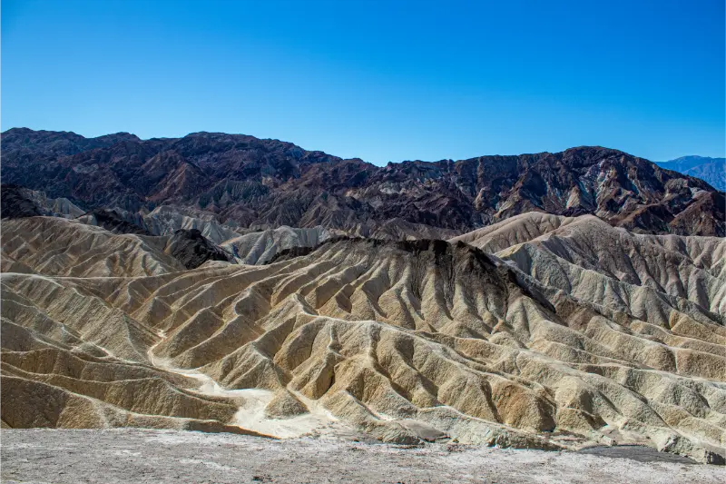
Return via Artists Drive if current road conditions and vehicle restrictions permit. The one-way scenic road adds color and geology to a day otherwise dominated by broad valley views. Finish near Furnace Creek or Zabriskie for late light.
How much hiking on Day 1?
Winter is the season when low-elevation hiking becomes realistic, but do not overcommit on your first morning. Golden Canyon, Badlands Loop sections and Natural Bridge each have different time requirements. Choose one primary hike based on fitness and daylight.
Carry water even in cool weather. Dry air can hide dehydration, and shade is limited. Never enter a canyon when storms or flash-flood conditions are a concern.
Day 2: dunes, viewpoints and a second landscape
Start at Mesquite Flat Sand Dunes before the sand heats and footprints accumulate. You do not need to reach the tallest dune to enjoy the landscape; wandering safely within sight of your route can be enough. Then choose between western/northern viewpoints or additional Furnace Creek-area hikes based on open roads.
Dante’s View can be spectacular when accessible, but the elevation means temperatures can be much colder than Badwater Basin. High-elevation roads may have winter conditions even when the valley floor is dry.
Road closures matter more than your saved map
Death Valley regularly experiences flood damage, construction and backcountry road closures. A route that worked last year may not work on your trip. Check the official Death Valley conditions page immediately before driving and again if weather changes.
Do not enter a closed road because another vehicle appears to have done so. Repairs in remote desert terrain can take months or years, and closed roads may be physically destroyed rather than merely inconvenient.
Winter weather and what to pack
Pack layers, a warm jacket for dawn/night, sun protection, sturdy footwear, more water than you expect to drink and food for periods away from services. A paper or offline map is useful because mobile coverage is unreliable. Fill the fuel tank before long excursions.
If you are combining Death Valley with the Sierra, remember that mountain passes may be seasonally closed. Our California desert road-trip guide shows a route that avoids assuming summer Sierra access.
Stargazing in winter
Death Valley’s dark sky is one of the best reasons to stay overnight. The park recommends locations such as Mesquite Flat Sand Dunes, Harmony Borax Works, Badwater Basin and Ubehebe Crater for night exploration, but choose a site that does not require risky night driving on unfamiliar roads.
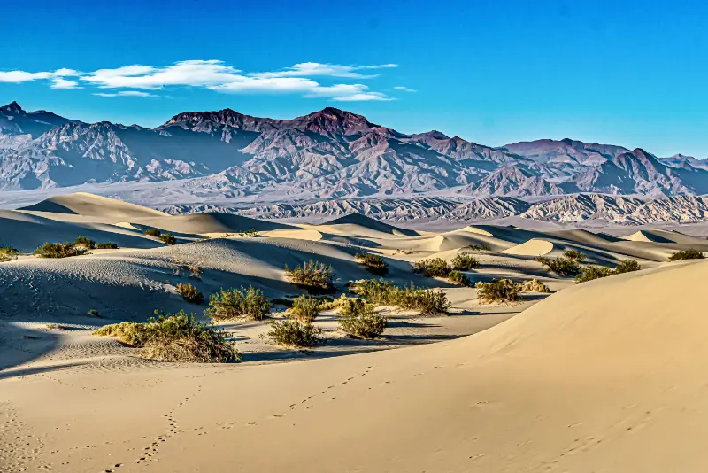
Check moon phase before the trip. A bright full moon can be beautiful on the landscape but will wash out many stars. Bring a red-light flashlight, warm clothing and a clear plan for returning to your lodging.
Death Valley with children in winter
Winter makes short walks more manageable for families, but distances between stops can still create boredom. Use the Junior Ranger program, keep snacks accessible and alternate walking with viewpoints. Salt flats and dunes are visually engaging even for children who are not enthusiastic hikers.
Never let children wander into abandoned mines or away from marked areas. Desert features can look close while actually being far across rough terrain.
For senior travelers
Winter is also the best season for travelers who prefer shorter outdoor periods. Many signature views require limited walking. Build the itinerary around Badwater Basin, Zabriskie Point, Artists Drive and easily reached viewpoints, then add only one longer walk.
The biggest challenge is not elevation gain but cumulative driving and getting in and out of the vehicle. Two slower days are usually better than one exhausting loop.
When not to force the plan
If heavy rain is forecast, rethink canyon hikes and low crossings. If high winds make dunes unpleasant, switch to sheltered or vehicle-based viewpoints. If snow or ice affects higher roads, stay on the valley floor. A Death Valley itinerary should be modular because conditions vary across elevations.
Final advice
Winter reveals Death Valley at a human pace. Use the cool days for low-elevation walks, stay close enough to enjoy dawn and darkness, and check road conditions instead of assuming every scenic drive is open. Two well-planned winter days can include salt flats, dunes, colorful badlands, canyon walking and stars without the heat management that dominates warmer seasons.
Photography and winter light
Low winter sun can emphasize textures in salt flats, dunes and badlands. The best photograph is not worth stopping in an unsafe road position, however. Use designated pullouts and walk only where access is permitted. At dunes, protect cameras from blowing sand and avoid changing lenses in strong wind.
Sunrise and sunset temperatures can differ sharply from midday. Keep gloves and a warm layer in the car even if you expect to photograph only for 20 minutes.
One last planning check
Before traveling, reopen the official pages for the places in this guide and verify hours, reservations, road conditions and weather. California conditions change by season, construction and natural events, and a saved itinerary should be treated as a framework rather than a contract. Build at least one flexible block into the day so a closure or delayed meal does not force you to abandon the rest of the plan.
Also confirm where you will park or how you will return to your hotel after dark. Small logistical decisions often determine whether Death Valley in Winter feels easy or stressful, especially for families, older travelers and anyone visiting California for the first time.
How to make the day easier
Start with the one experience you would be most disappointed to miss and place it in the best part of the day for weather, crowds or reservations. Treat everything else as adjustable. Keep water, a light layer, a portable battery and an offline map available, and avoid storing luggage in a visible part of a parked car. If you are traveling with children or older relatives, schedule a real seated break before anyone asks for one; waiting until the group is tired usually turns a small delay into a difficult afternoon.
Finally, resist the urge to add a distant attraction simply because the map shows it within driving range. California traffic, parking and scenic-road delays make geographic distance a poor measure of effort. A shorter day with time to look around, eat properly and adapt to conditions usually produces a better trip than collecting one more stop.
Budget and timing buffer
Keep a modest buffer in both time and money. Parking, food, entrance charges, fuel and last-minute transport can cost more than expected, while a busy queue or road delay can remove an hour from the plan. Decide in advance which stop is optional so you know what to drop without debate. This is especially useful on weekends, holidays and school-break periods when visitor patterns can change quickly.
Download reservation confirmations and key addresses before leaving reliable Wi-Fi. If your day depends on a timed entry, ferry, tour or sunset arrival, work backward from that commitment and keep the previous part of the itinerary nearby. The most comfortable California travel days usually have one fixed anchor and several flexible pieces around it.