Winter can make Big Sur feel more dramatic and less crowded, but it removes the certainty that a fixed road-trip itinerary needs. Rain, rockfall, slides, temporary traffic controls and short daylight hours can change the value of a stop or the feasibility of through-driving.
Who this guide is best for: Travelers who can keep reservations flexible, enjoy stormy coastal scenery and are comfortable making route decisions from current Caltrans information rather than an old blog itinerary.
Quick planning summary
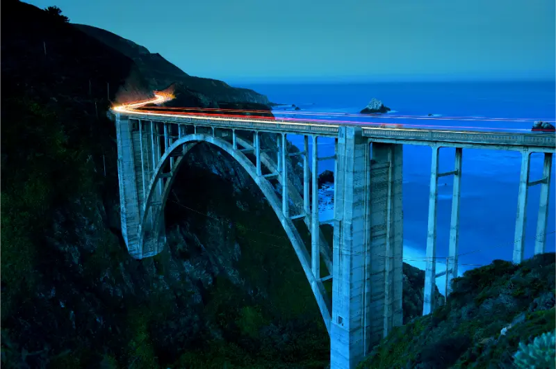
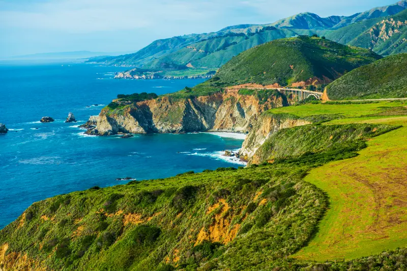
- Day 1: base in Carmel or Monterey, check Highway 1 before departure, then choose a north Big Sur loop with Bixby Creek Bridge, Point Sur viewpoints, Pfeiffer Big Sur area and one short walk.
- Day 2: continue south only as current road conditions allow, prioritizing McWay Falls/Julia Pfeiffer Burns area, coastal pullouts and a relaxed lunch rather than chasing a fixed endpoint.
Why this trip needs a different strategy
Winter is California’s wetter season on the Central Coast. A rainy day is not automatically a lost day, but exposed trails, bluff edges and river crossings deserve more caution.
Highway 1 conditions can change after storms. Caltrans road information should be the final authority, and a closure may force an out-and-back trip instead of a through-route.
The practical goal is not to maximize the attraction count. It is to put the most time-sensitive or location-sensitive experience in the right part of the day, then keep nearby options flexible. That approach matters even more on weekends, school holidays and periods of unusual weather.
A realistic itinerary
Plan 1
Day 1: base in Carmel or Monterey, check Highway 1 before departure, then choose a north Big Sur loop with Bixby Creek Bridge, Point Sur viewpoints, Pfeiffer Big Sur area and one short walk.
Keep the surrounding hours simple. Add one nearby meal, walk, viewpoint or rest period rather than another cross-region transfer. If the main stop takes longer than expected, let the secondary stop go; California trips improve quickly when the schedule has room to absorb reality.
Plan 2
Day 2: continue south only as current road conditions allow, prioritizing McWay Falls/Julia Pfeiffer Burns area, coastal pullouts and a relaxed lunch rather than chasing a fixed endpoint.
Keep the surrounding hours simple. Add one nearby meal, walk, viewpoint or rest period rather than another cross-region transfer. If the main stop takes longer than expected, let the secondary stop go; California trips improve quickly when the schedule has room to absorb reality.
Important practical details
Whale migration can add interest to winter coastal viewpoints, but wildlife sightings should be treated as a bonus rather than a guaranteed activity.
Some lodging and restaurants operate on reduced schedules in quieter periods. Confirm opening days, especially midweek.
How long to allow
A realistic trip is built around energy and transfer time, not the number of pins saved on a map. If you have only one day, protect the main experience and remove distant extras. With two or three days, add a contrasting neighborhood, landscape or activity rather than repeating the same type of sightseeing. Families should also count check-in, parking, meals and rest as real itinerary time.
Where to stay
Location usually matters more than a small difference in nightly rate. A hotel that reduces two long drives can improve the trip more than an extra amenity. Compare parking, breakfast, resort or destination fees, room layout and walking access before choosing. For multi-night stays, the ability to reach dinner without another major drive is especially valuable.
Getting around
Use a route that minimizes backtracking. Download offline maps before mountain, coastal or remote sections, and keep one nearby backup stop in case weather, parking, construction or a closure changes the plan. In cities, combine transit with walking where it is efficient; in rural areas, assume cell coverage and rideshare availability may be inconsistent.
What to book ahead
Reserve the experiences that can genuinely sell out: limited-entry attractions, ferries, special tours and high-demand lodging. Keep weather-dependent outdoor time more flexible. When a reservation has a fixed start time, build the surrounding day around it instead of hoping traffic, parking and meals will fit into the gaps.
Families, teenagers and multigenerational groups
For families, winter Big Sur works best when the day has one indoor or sheltered fallback, such as Monterey before or after the coast. Teenagers often enjoy photography and dramatic surf; younger children need shorter outdoor blocks and dry clothing. Older travelers should prioritize overlooks with safe parking and stable surfaces.
For mixed-age groups, agree on the non-negotiable activity before the day begins and identify an easy exit point. A successful family day does not require everyone to love every stop. It requires enough shared highlights, predictable food and restroom breaks, and permission to shorten an activity when the group has reached its limit.
Budget strategy
Separate the budget into accommodation, parking or transport, food, paid attractions and optional upgrades. California trips often become expensive through small repeated costs rather than one headline ticket. Decide which experience deserves the splurge, then use parks, beaches, viewpoints, neighborhood walks and picnics to balance the rest.
Accessibility and comfort
Check the exact parking area, surface, slope, stairs, shade and restroom availability for the specific stop you plan to use. “Easy” can mean short but steep, paved but exposed to heat, or flat but far from parking. For older travelers and anyone with limited mobility, one well-chosen accessible viewpoint can be more rewarding than forcing the most famous trail.
Weather and backup plans
California weather changes sharply with elevation and distance from the ocean. Carry layers even on warm trips, and treat heat, wind, surf, smoke, snow or rain as itinerary variables rather than surprises. A useful backup plan should be geographically close to the original stop; replacing a closed trail with an attraction two hours away usually creates a second problem.
Common mistakes to avoid
- Building a nonrefundable point-to-point itinerary that depends on highway 1 being fully open.
- Parking illegally at scenic bridges or blind curves.
- Underestimating how early darkness arrives in winter.
- Choosing long exposed hikes immediately after heavy rain.
Another common mistake is treating driving as empty time. Traffic, winding roads, finding parking and walking from the car all consume energy. If the next destination requires a long transfer, shorten the final morning rather than beginning the drive after an already exhausting schedule.
How this fits into a longer California trip
Avoid adding the destination simply because it looks close on a statewide map. California driving days are tiring, and mountain or coastal roads can make modest mileage slow. Pair stops that share a geographic corridor, then protect at least one lighter half-day after a major transfer or full-day attraction.
Useful California for You guides to read next
Also compare this plan with Big Sur in two days, Big Sur with kids, and Monterey, Carmel and Big Sur itinerary.
Official information to check before you go
Use Caltrans current highway conditions for the latest operating status, access rules, closures or transport information. Conditions and policies can change after this article is published.
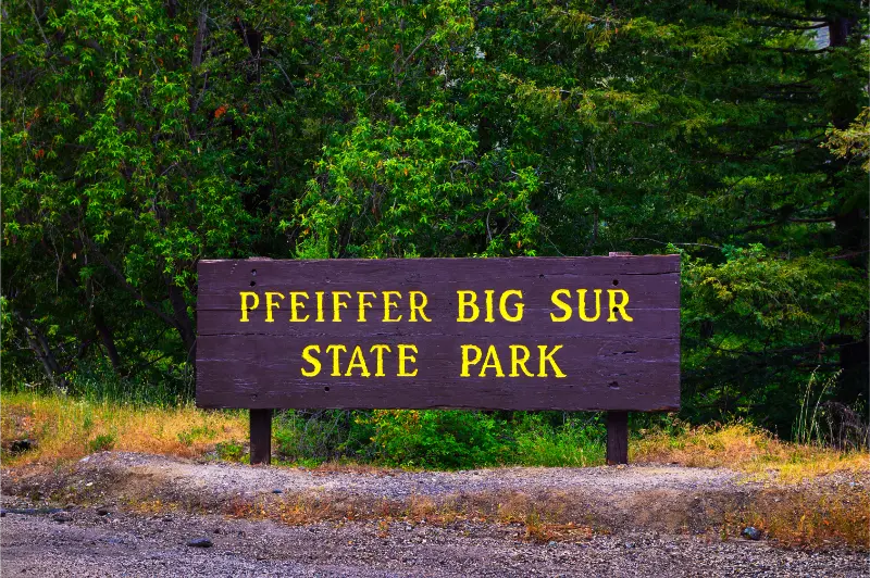
Use Pfeiffer Big Sur State Park for the latest operating status, access rules, closures or transport information. Conditions and policies can change after this article is published.
Final advice
The strongest version of this trip is the one that leaves enough margin for what California actually gives you that day: traffic, fog, heat, a perfect sunset, a child who wants to stay longer, or a road that takes more time than expected. Choose a few experiences worth protecting, keep the rest flexible, and use official sources for anything that can change quickly.
Planning notes that make a real difference
Winter is California’s wetter season on the Central Coast. A rainy day is not automatically a lost day, but exposed trails, bluff edges and river crossings deserve more caution. The safest way to use this guide is to treat dates and times as planning frameworks, then reconfirm the final operating information close to travel. This is especially important when a road, trail, ferry, seasonal service or timed-entry system influences the entire day.
Pack around the least comfortable part of the day rather than the average forecast. That usually means carrying water, a warmer layer, sun protection and a small snack even when the main activity is urban. Families benefit from keeping one simple emergency meal or snack option available so hunger does not turn a traffic delay into a bad decision.
Photography and viewpoints can also distort itineraries. A famous stop that takes five minutes on a quiet weekday may require a long parking search on a holiday weekend. If the parking situation feels unsafe or illegal, skip the exact photo and use the next legitimate turnout or viewpoint. The experience matters more than reproducing one image.
Finally, distinguish between a destination that deserves an overnight stay and one that works as a day trip. Staying closer often changes the quality of mornings and evenings, but moving hotels too frequently creates its own cost. On a longer California journey, two- and three-night bases are usually more relaxing than a chain of one-night stops.
Planning notes that make a real difference
Winter is California’s wetter season on the Central Coast. A rainy day is not automatically a lost day, but exposed trails, bluff edges and river crossings deserve more caution. The safest way to use this guide is to treat dates and times as planning frameworks, then reconfirm the final operating information close to travel. This is especially important when a road, trail, ferry, seasonal service or timed-entry system influences the entire day.